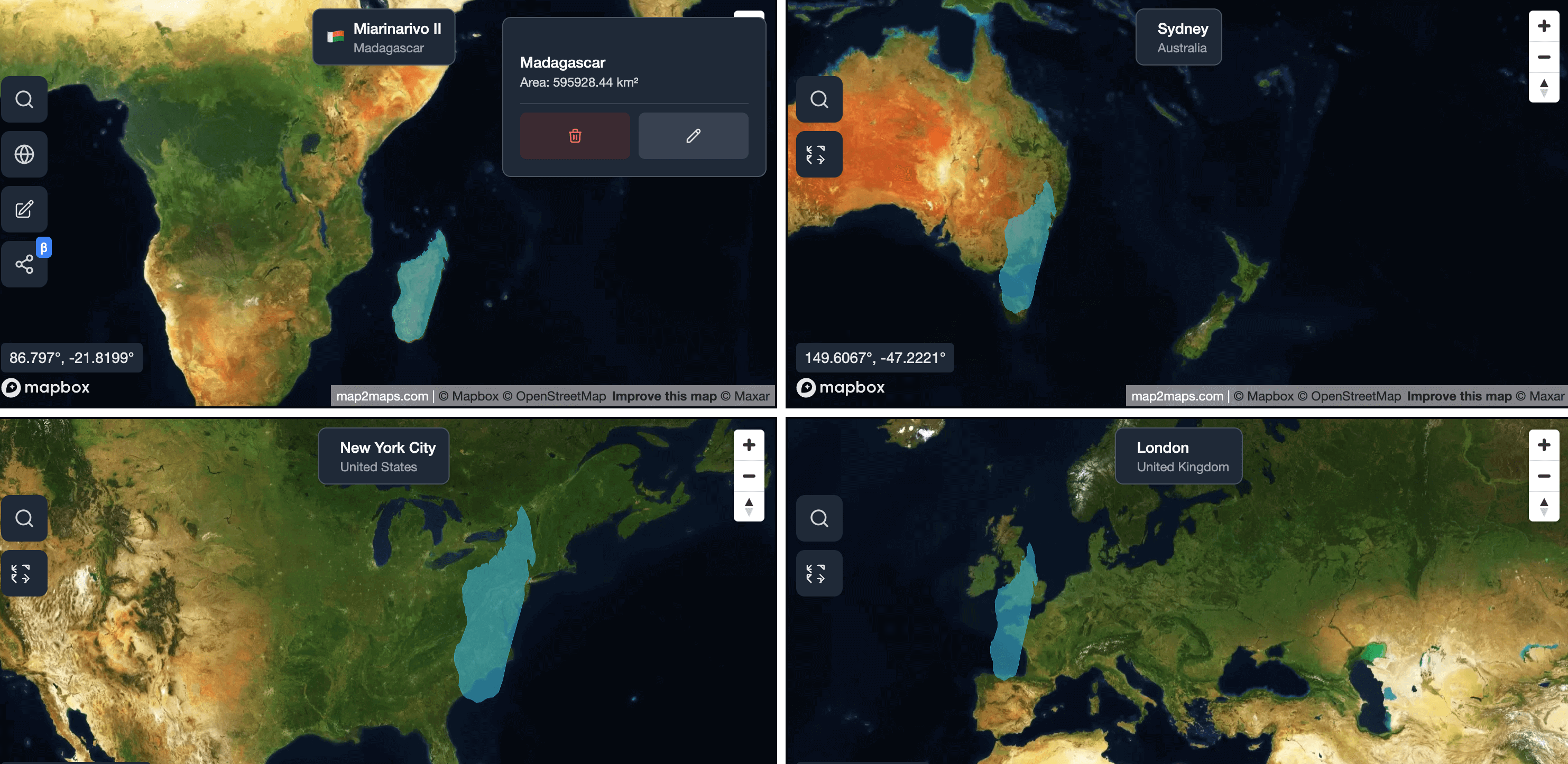
How Big is Madagascar Really? A Map Projection Perspective
See the true size of Madagascar and how different map projections make this island nation appear larger or smaller than it actually is.
Map2Maps Team
Madagascar's size often appears inconsistent across different map projections. This island nation off Africa's east coast is significantly larger than many people realize.
The Numbers
- Madagascar's area: 587,041 square kilometers (226,658 square miles)
- Population: About 28 million people
- Location: Off Africa's east coast in the Indian Ocean
Quick Comparison: - Madagascar is about 1.5 times the size of Germany
- It's roughly 80% the size of Texas - Madagascar is 2.5 times larger than the United Kingdom
The Mercator Distortion Effect
The Mercator projection excels at navigation but distorts true sizes, especially for locations far from the equator. Madagascar can appear tiny next to Greenland on Mercator maps, but the reality is quite different.
Madagascar (587,041 km²) is about 27% the size of Greenland (2,166,086 km²) - much closer than most maps suggest.
Comparing Madagascar to Other Countries
Larger than Madagascar:
- Turkey: 783,562 km² (33% larger)
- Chile: 756,096 km² (29% larger)
- France: 643,801 km² (10% larger)
Smaller than Madagascar:
- Spain: 505,370 km² (14% smaller)
- California: 423,967 km² (28% smaller)
- Germany: 357,022 km² (39% smaller)
Island Nation Comparisons
Among the world's largest islands, Madagascar ranks impressively:
- Greenland: 2,166,086 km² (3.7x larger)
- New Guinea: 785,753 km² (34% larger)
- Madagascar: 587,041 km²
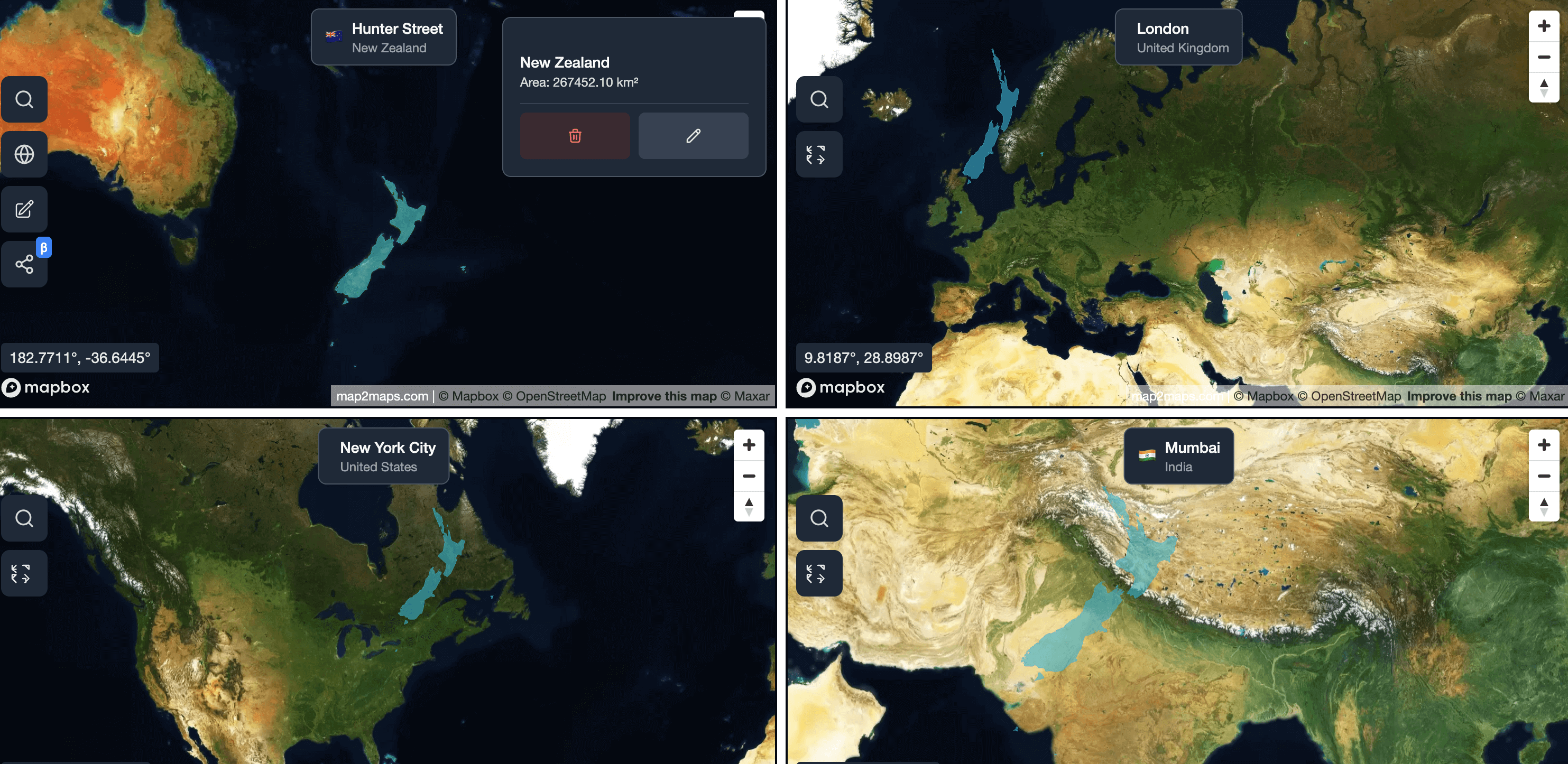
- New Zealand: 268,021 km² (54% smaller)
- United Kingdom: 243,610 km² (58% smaller)
Sponsored
Products we use and recommend
Support Map2Maps by checking out these tools.
Send money internationally with Wise
Save up to 6x on international transfers with real exchange rates
Learn Languages with Langi.app
Read bite-sized stories with audio to learn languages at your level
Ship faster with bunny.net
Global CDN, storage, and media delivery tools that keep websites and video fast worldwide.
Move faster with Raycast
A keyboard-first launcher with extensions, snippets, and AI to speed up everyday work.
Build referral programs with Refgrow
A referral program platform for SaaS and AI products with automated tracking, commission management, and payouts.
Interactive Exploration
Explore this comparison on our interactive map tool
Explore Interactive MapUse the interactive map to see how Madagascar compares when placed over different continents and countries.
Why This Matters
Understanding Madagascar's true size matters for several reasons. It corrects common geographic misconceptions. Madagascar's unique ecosystem and culture deserve recognition proportional to the island's actual scale. The territory's size helps contextualize its economic potential and challenges.
The Gall-Peters Alternative
The Gall-Peters projection shows countries in their true relative sizes. On this projection, Madagascar appears much more prominently, providing a better sense of its actual importance in the Indian Ocean region.
Fun Facts About Madagascar
- Home to 5% of the world's species, with 80% found nowhere else on Earth
- Separated from the African continent about 160 million years ago
- Known for unique wildlife including lemurs, fossas, and Madagascar hissing cockroaches
- Has 18 official languages, though Malagasy and French are most widely spoken
Conclusion
Madagascar is considerably larger and more significant than many map projections suggest. This island nation, with its unique biodiversity and rich culture, deserves recognition for its true geographic importance.
Use our interactive map tool to compare Madagascar with any country or region. Also check out how Brazil compares to India for another dramatic size difference.
Related Articles
Argentina vs. Algeria: A Transatlantic Size Comparison
See how Argentina and Algeria compare in land area, and why map projections can make their sizes look different than they really are.
Egypt vs. Turkey: Comparing Two Crossroads of Continents
See how Egypt and Turkey compare in land area, and why map projections can make their sizes look different than they really are.
How Big is Australia Compared to the United States?
Discover the surprising size difference between Australia and the United States, and how the Mercator projection affects our perception of both countries.
Explore for Yourself
Ready to dive deeper? Use our interactive tools to compare countries, explore map projections, and see these geographic concepts in action.