Is Brazil Bigger Than India? Yes, by 2.6 Times
Brazil covers 8,515,767 km² to India's 3,287,263 km², about 2.6 times larger. Drag Brazil onto India on our interactive map to see the 5.23m km² gap.
Map2Maps Team
Brazil and India are both large, populous nations with significant global influence. The size gap between them is considerably wider than most people would guess from a world map.
Key Takeaways: - Brazil covers 8,515,767 km² against India's 3,287,263 km², roughly 2.6 times larger - India holds six times Brazil's population in less than half the space - The 5.23 million km² gap between them exceeds the area of any country outside the top four
How Much Bigger is Brazil Than India?
Brazil is about 2.6 times the size of India. Brazil covers 8,515,767 km² and India covers 3,287,263 km² (CIA World Factbook, 2026), which leaves a gap of roughly 5.23 million km². That difference on its own would rank as the world's fifth-largest country.
Population runs the other way entirely. Brazil has around 215 million people, while India has around 1.4 billion (World Bank Open Data, 2026).
Where Do They Rank Globally?
Brazil is the 5th largest country in the world, behind Russia, Canada, the United States, and China. India ranks 7th. Both sit comfortably inside the top ten, and that shared billing is what hides the gap.
When two countries are filed under the same mental heading of "huge," the mind tends to treat them as peers. The arithmetic disagrees.
Why Do Maps Make Them Look Similar?
The Mercator projection stretches land progressively toward the poles, so countries near the equator are drawn closest to their true proportions. Scale factor is the multiplier a projection applies at a given latitude, and on Mercator it works out to approximately 1/cos(latitude).
Brazil's centroid sits near 10°S, giving a scale factor of about 1.02. India's sits near 23°N, for roughly 1.09. Neither figure looks dramatic in isolation.
The two distortions push in opposite directions, however. Brazil is rendered at nearly its honest size while India picks up a modest boost, and the visual gap narrows accordingly. As a result, a reader scanning a standard world map sees two large blocks that appear far closer in size than they actually are.
Select Brazil and India on the map to see their true sizes side by side.
How Are the Two Countries Shaped?
Broad and blocky, Brazil spans roughly 4,395 km east-west and 4,320 km north-south, which makes its overall footprint almost square. It borders every South American country except Chile and Ecuador, crossing the equator in the north and reaching temperate latitudes near the Uruguayan border in the south.
India, conversely, tapers. The country runs about 3,214 km north-south and 2,933 km east-west, narrowing to a point at Kanyakumari.
That taper matters more than the raw dimensions suggest. India climbs from tropical coastline to the highest mountains on the planet within a few hundred kilometres, compressing climate zones into a space that Brazil spreads across thousands of kilometres of comparatively uniform lowland.
Which Country Has More People?
India, by an enormous margin. India holds roughly 1.4 billion people at about 431 per km², whereas Brazil holds around 215 million at roughly 25 per km², making India some 17 times more densely populated.
One Indian state makes the point on its own: Uttar Pradesh has more residents than all of Brazil.
The Amazon basin accounts for much of this asymmetry. Roughly 60% of Brazil's territory is rainforest that supports very low population densities, so the overwhelming majority of Brazilians live along the Atlantic seaboard while the interior remains close to empty. Around 87% of the national population is urban, and those cities cluster within a few hundred kilometres of the coast. In contrast, India's population spreads across river plains, plateaus, and coastlines that have supported dense settlement continuously for millennia. The result is two countries whose population maps look nothing alike. Brazil's is a bright rim around a dark interior; India's is a broad wash of settlement broken only by the Thar Desert and the high Himalayas. Notably, this is why area alone is such a poor predictor of a country's population, and why the two rankings invert so sharply here.
Compare Any Country on Earth
Save unlimited comparisons and return to them whenever you need them, with priority support included.
Terrain and Relief
Two systems govern Brazil: the Amazon rainforest across the north and west, and the Brazilian Highlands through the centre and south. By global standards the country has no major mountains, since Pico da Neblina, its highest point, reaches only 2,995 m.
India, meanwhile, packs substantially more relief into less space. The Himalayas seal the northern border, with Kangchenjunga at 8,586 m, and below them lie the Indo-Gangetic Plain, the Thar Desert, the Deccan Plateau, and the Western and Eastern Ghats framing the peninsula.
The monsoon is the seasonal wind reversal that delivers the bulk of India's annual rainfall in a few concentrated months. Notably, nothing in Brazil's climate operates on that kind of switch.
Interactive Exploration
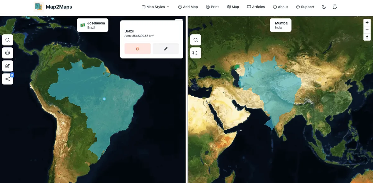
Explore this comparison on our interactive map tool
Explore Interactive MapWhen we measured both boundaries with Turf's geodesic area function rather than reading them off a projected map, the ratio came out at 2.59 to 1. Drag India onto Brazil above and that difference lands immediately, in a way no side-by-side world map manages.
Which Economy is Larger?
India's total output is larger, yet Brazil's output per person is considerably higher.
Brazil:
- GDP: ~$2.2 trillion
- GDP per capita: ~$10,300
- Major industries: Agriculture, mining, aerospace, energy
- Global role: Largest economy in South America
India:
- GDP: ~$3.7 trillion
- GDP per capita: ~$2,600
- Major industries: IT services, pharmaceuticals, textiles, agriculture
- Global role: Among the fastest-growing major economies
This mirrors the area comparison, inverted. India reaches the bigger total through population rather than productivity per head, in exactly the way it reaches a bigger population through density rather than territory.
Agriculture Under Opposite Constraints
Both countries feed a large share of the world, but they got there from opposite starting points.
With abundant arable land relative to its population, Brazil has pushed production aggressively into the cerrado savanna. It leads the world in soybean, coffee, sugar, and beef exports. Land is not the binding constraint here. Instead, infrastructure and environmental pressure are.
India, on the other hand, farms a smaller area far more intensively. It leads the world in milk production and ranks near the top for rice, wheat, cotton, and sugarcane. With roughly half its workforce in agriculture and considerably less land per person, yield per hectare carries enormous weight, and monsoon variability therefore drives the year-to-year swings.
Fun Facts
Brazil:
- Holds about 60% of the Amazon rainforest
- The only country to have played in every FIFA World Cup
- Borders 10 of South America's 12 countries
- Its Atlantic coastline runs roughly 7,491 km
India:
- Home to Mawsynram, the wettest inhabited place on Earth
- Recognises 22 official languages
- The Ganges basin supports more people than any other river basin anywhere
- Spans a single official time zone despite being nearly 3,000 km wide
Conclusion
On land area Brazil is more than twice India's size, while India holds over six times Brazil's population in less than half the space. Both are giants; the two are simply measured on different axes.
The comparison is a useful reminder that "big country" means at least two separate things. On a map, Brazil dwarfs India. In a room full of people, the ratio flips completely.
Sources and method
- Country areas: CIA World Factbook
- Population and GDP: World Bank Open Data
- Boundary geometry: Natural Earth
Method: boundaries come from Natural Earth 3.3.0 (1:50m). Areas are computed with Turf's geodesic area function over the polygon geometry, so they do not depend on the Web Mercator projection used for display. Figures include inland water and follow each source's treatment of disputed boundaries.
Note: Brazil's area follows the figure published by IBGE, the national statistics institute, which differs slightly from some international datasets.
Figures checked 17 August 2026.
Frequently Asked Questions
How much bigger is Brazil than India?
Which country has more people, Brazil or India?
Why do Brazil and India look similar in size on maps?
Which country has the larger economy?
Why is so much of Brazil empty?
Use our interactive map tool to compare Brazil and India with any country or region in the world. Also check out Argentina vs Algeria for another intercontinental comparison, India vs. China for another India-scale matchup, or China vs the United States for two more giants that look nothing like their true sizes on a standard map.
Related Articles
Bangladesh vs. Greece: Similar Land, 17x the People
Bangladesh covers 148,460 km² to Greece's 131,957 km², about 13% larger. Yet Bangladesh holds nearly 17 times Greece's population.
Colombia vs. Spain: Similar Populations, 4x Wealth Gap
Colombia covers 1,138,910 km² to Spain's 505,370 km², more than double. Populations are nearly identical, yet Spain's economy is 4x bigger.
India vs. China Size Comparison: China Is 3x Bigger
China covers 9,596,961 km² to India's 3,287,263 km², almost 3x larger. Yet India overtook China in population in 2023.
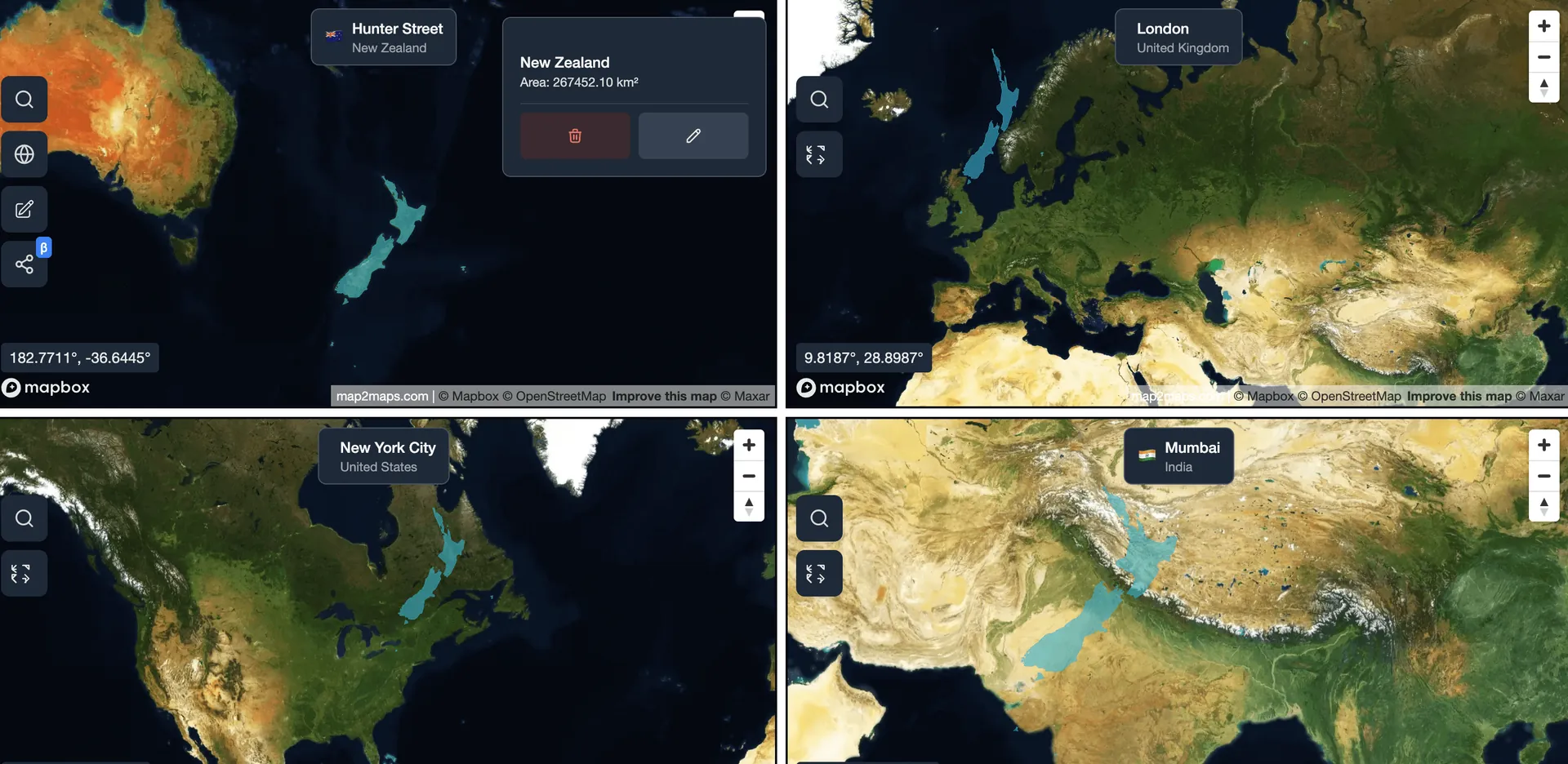
Explore for Yourself
Ready to dive deeper? Compare countries and see how Web Mercator changes their apparent size at different latitudes.
Sponsored
Products we use and recommend
Support Map2Maps by checking out these tools.
Sponsored
Send money internationally with Wise
Save up to 6x on international transfers with real exchange rates
Try WiseSponsored
Learn Languages with Langi.app
Read bite-sized stories with audio to learn languages at your level
Start LearningSponsored
Ship faster with bunny.net
Global CDN, storage, and media delivery tools that keep websites and video fast worldwide.
Explore bunny.netSponsored
Move faster with Raycast
A keyboard-first launcher with extensions, snippets, and AI to speed up everyday work.
Try RaycastSponsored
Build referral programs with Refgrow
A referral program platform for SaaS and AI products with automated tracking, commission management, and payouts.
Explore Refgrow